

Local drone surveys in Chelmsford, planned around the site and the airspace.
Chelmsford is the only place on our patch that behaves like a city rather than a market town, and the survey work reflects that. Between the Chelmer Waterside regeneration on the former gas works, the Beaulieu and Channels expansion to the north-east, and steady infill around Springfield and Great Baddow, there is nearly always something under construction here. We get called out for monthly progress imagery on residential phases, flat-roof condition surveys over the Bond Street and High Chelmer retail blocks, warehouse roof inspections across the Widford employment area, and pre-planning topographic capture on the greenfield edges near the ring road. Wrap that around a compact Georgian and Victorian core along New London Road and Moulsham Street and a single day can mix commercial, heritage and construction work.
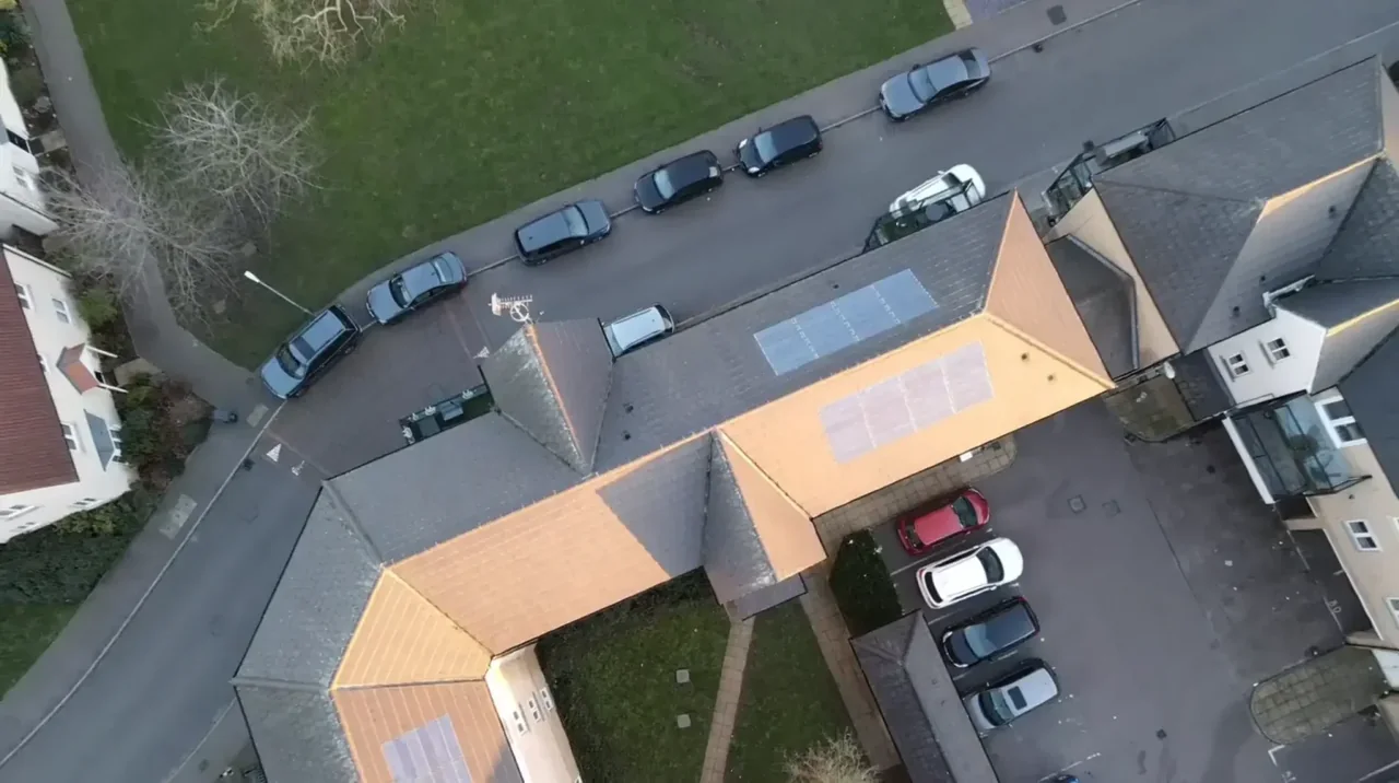
The buildings and sites we survey in Chelmsford
Chelmsford's stock splits three ways. The historic core and its conservation areas — Chelmsford Central around the cathedral and High Street, plus New London Road, Moulsham Street, Springfield Green and the Chelmer and Blackwater Navigation — hold Georgian and Victorian frontages with slate and clay-tile pitches, parapet gutters and hidden rear valleys. Around them sit interwar and postwar semis through Springfield, Melbourne and Great Baddow, mostly concrete-tile pitches carrying later dormers and rear extensions. Then there is the newer stock: apartment blocks at Beaulieu, Channels and Chelmer Waterside with single-ply and membrane flat roofs, and the trade units and distribution sheds of the Widford and Springfield employment areas, where profiled metal decking and rooflights dominate.

What we get asked for in Chelmsford
Surveys we fly in Chelmsford
Every survey is scoped to your project before we fly — you receive the outputs that are actually useful to you, and a clear, no-obligation quote first.




Drone surveys in Chelmsford — frequently asked questions
How quickly can you get to a site in Chelmsford?
We are based at North Weald near Epping, about fifteen miles by road along the A414, so Chelmsford is comfortably a same-morning arrival. Most Chelmsford jobs are a single short visit rather than a multi-day booking, and imagery, video and the written report usually follow within a few days of the flight.
Can you survey a roof inside the Chelmsford Central or Moulsham Street conservation area?
Aerial imagery can help record visible roof condition in Chelmsford without attaching equipment to the building. We review access, people and activity nearby, current airspace information and the operating limits that apply to the proposed work. Any required permissions must be obtained, and suitable weather is needed on the day. We confirm feasibility and the scope we can capture before booking; if the flight cannot be carried out safely and lawfully, we discuss an alternative or decline the work.
Do you fly near HMP Chelmsford?
We assess each Chelmsford site individually before confirming a drone survey. We review access, people and activity nearby, current airspace information and the operating limits that apply to the proposed work. Any required permissions must be obtained, and suitable weather is needed on the day. We confirm feasibility and the scope we can capture before booking; if the flight cannot be carried out safely and lawfully, we discuss an alternative or decline the work.
Can you monitor a construction site over several months?
Yes, and Chelmsford is where we do most of it. We fly the same flight lines and camera positions on each visit so the images stack up as a genuine comparison rather than a set of unrelated photos, which is what makes them useful for valuations, funder reports and progress claims. Frequency is usually monthly, but we scope it around your programme.
We also cover, near Chelmsford
Based in North Weald, Epping and covering London, Essex, Hertfordshire, Kent and the wider South East. If your site is not listed, check we cover it →
