

Local drone surveys in Great Dunmow, planned around the site and the airspace.
Great Dunmow is the northern edge of our patch and the one town in this cluster where airspace has to be settled first. It is a medieval market town on the Roman Stane Street, with a market charter from 1227, a conservation area exceptionally rich in listed buildings, and the church of St Mary the Virgin standing apart from the centre at Church End. It is also growing hard: Woodlands Park and the large sites west of Woodside Way have between them added hundreds of new homes, with later phases of housing and community facilities still coming forward. So the work splits between historic roofs in the old town and topographic and progress capture on live housing land.
The buildings and sites we survey in Great Dunmow
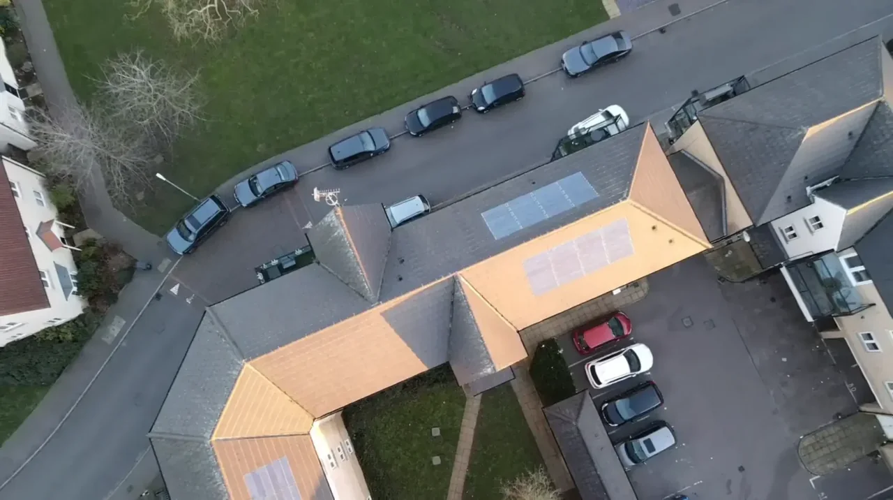
Dunmow's centre is a genuinely mixed conservation area, packed with listed buildings — from the sixteenth-century timber-framed Clock House to Georgian brick fronts around the market place and High Street, with plain clay tile, pantile and slate roofs and the awkward hidden valleys that sit behind a symmetrical frontage. The medieval Church of St Mary the Virgin is at Church End, away from the town centre. Around this is twentieth-century suburb and then the new build: Woodlands Park and the large housing sites west of Woodside Way, brick-and-tile estates built out in phases. Light industry is concentrated on the Chelmsford Road estates.

What we get asked for in Great Dunmow
Surveys we fly in Great Dunmow
Every survey is scoped to your project before we fly — you receive the outputs that are actually useful to you, and a clear, no-obligation quote first.




Drone surveys in Great Dunmow — frequently asked questions
Is Great Dunmow inside a no-fly zone because of Stansted?
The answer depends on the exact address in Great Dunmow, the current airspace restrictions and the proposed flight. Proximity to an airport or a place name alone does not establish whether a flight is possible. We review access, people and activity nearby, current airspace information and the operating limits that apply to the proposed work. Any required permissions must be obtained, and suitable weather is needed on the day. We confirm feasibility and the scope we can capture before booking; if the flight cannot be carried out safely and lawfully, we discuss an alternative or decline the work.
Who gives permission if my site does fall inside a restriction zone?
The relevant authority depends on the restriction affecting the Great Dunmow site. We identify the permission route from current published information and confirm the requirements and lead time before agreeing a date. We review access, people and activity nearby, current airspace information and the operating limits that apply to the proposed work. Any required permissions must be obtained, and suitable weather is needed on the day. We confirm feasibility and the scope we can capture before booking; if the flight cannot be carried out safely and lawfully, we discuss an alternative or decline the work.
Can you do the topographic survey for a housing site here?
Yes. A drone topographic survey gives you a scaled topographical drawing, contours and spot heights, a digital terrain model and a 3D point cloud your engineers and architects can take into CAD, planning or BIM. We capture the whole surface rather than sample points. The accuracy achievable depends on the site, the flight plan and the level of detail agreed at briefing, and we are clear about that before we fly.
You are based near Epping — is Dunmow too far?
No. North Weald is about fifteen miles from Great Dunmow by road, either up the M11 and across on the A120 or across country on the B184, and we cover the whole of west and north Essex. Dunmow is far enough out that the airspace picture differs from the Epping end of our patch, which is exactly why we treat it as its own planning problem rather than assuming what applies further south.
We also cover, near Great Dunmow
Based in North Weald, Epping and covering London, Essex, Hertfordshire, Kent and the wider South East. If your site is not listed, check we cover it →
