

Drone Building & Facade Survey in London & Essex
High-resolution facade, cladding, brickwork and guttering assessments — capturing hard-to-reach building detail safely, without scaffolding or disruption.
Request a quoteClose inspection of the whole building envelope.
A drone building and facade survey gives you a close, high-resolution view of a building's external envelope — facades, cladding, brickwork, masonry, parapets, downpipes and window surrounds — without scaffolding, cherry pickers or anyone working at height. Working across London, Essex, Hertfordshire, Kent and the wider South East as part of the full range of drone surveying we fly, we capture the detail that matters for condition assessments, maintenance planning and pre-purchase decisions.
We fly a professional survey-grade drone across the elevations to record exactly what condition the structure is in. Every flight is carried out by a professional drone operator in line with CAA regulations and the UK Drone Code.
Building survey or roof survey — which do you need?
The quick test is which way you would have to look.
Looking sideways — brickwork and pointing, render, cladding panels and fixings, masonry, parapets and copings, downpipes and hoppers, window and door surrounds, and the site around the building. That is this page: a drone building and facade survey.
Looking down — tiles, slates, ridges, hips, valleys, flashing, chimney stacks, flat-roof coverings, roof lights and high-level gutters. That is a drone roof survey.
Plenty of buildings need both, and when they do we fly them in the same visit and report them together rather than charging you for two trips. If you are not sure which side your problem sits on, describe it on the phone — 020 8058 0914 — and we will tell you.
How a drone building survey works
Initial Enquiry
Tell us about the building, its height and construction, and what you need to find out — a facade condition survey, a dilapidations record, a pre-purchase check or planned maintenance. We confirm the location, check the airspace and any considerations near aerodromes such as North Weald and Stapleford, then send a clear quote on scope with no obligation.
Shoot Day
Our operator attends site with a professional survey-grade drone and methodically captures every elevation — brickwork, cladding, masonry, render, parapets, downpipes and window surrounds. We photograph the whole envelope and take close-ups of anything that needs a closer look, with no scaffolding and no one working at height.
Analysis & Evaluation
Back at base, we review the imagery and video, identify defects and areas of concern across the elevations, and compile a clear condition report with every finding tied to an image. You receive your imagery, video and written report, usually within a few days, and we talk you through the findings so you or your surveyor can plan the next steps.
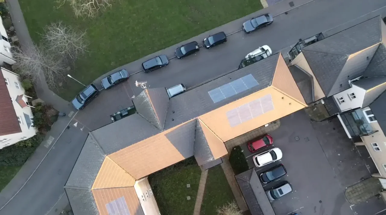
What a drone building survey covers — every elevation
A building and facade survey uses a professional survey-grade drone to record the full vertical envelope of a structure in high resolution — brickwork and masonry, cladding panels and fixings, render, parapets and copings, downpipes and hoppers, and window and door surrounds — close enough to pick out cracked pointing, spalled brick, failed sealant and blocked rainwater goods, all with the operator safely on the ground.
It suits homeowners, developers, managing agents, surveyors and property managers who need a clear, current picture of a building's condition. From tall period facades and awkward parapets to commercial cladding and hard-to-reach elevations, you get a genuine close-up view of areas that are difficult, costly or unsafe to inspect by traditional means.
Drone building survey vs scaffolding and cherry pickers
Inspecting a building the traditional way means scaffolding, access towers or a cherry picker — slow to arrange, costly to hire and disruptive to the site and its occupants. A drone reaches every elevation, parapet and roofline from the air in a single short visit, so there is no access equipment to erect and dismantle, no road or footpath closures, and no one working at height.
The high-resolution imagery and video give you and your surveyor solid evidence of the building's condition — useful for planned maintenance, dilapidations, insurance and damage assessments, cladding reviews and supporting a purchase decision. Because the survey is non-invasive, in most cases the building stays fully in use while we fly.
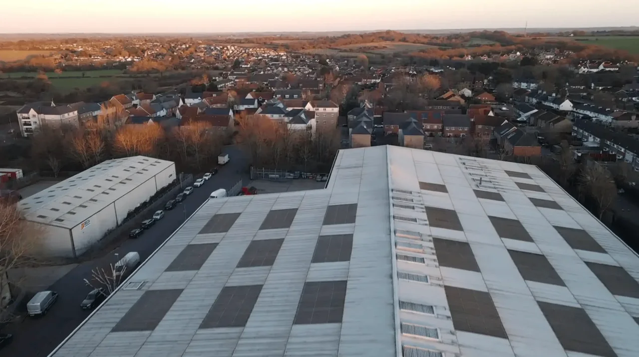
Dilapidations, insurance and pre-purchase — what the report is used for
Dilapidations. At the start of a lease, a drone survey gives you a dated photographic schedule of condition covering elevations a person on the ground simply cannot see — which is exactly where an argument lands three years later. At the end of a lease, it gives you the same view to compare against. Either way the value is in the fact that it is dated, high-resolution and comprehensive rather than a handful of phone photos taken from the car park. Talk to us about a schedule of condition.
Insurance and storm damage. After a storm, the question is usually how much moved and when. Dated aerial imagery of every elevation, with close-ups of the damage in context, is far stronger evidence than a description — and it is available within days rather than after a scaffold has been erected. We do not deal with your insurer for you, and we would not pretend to; what we do is give you a record they can act on.
Pre-purchase and pre-lease. Buyers and their surveyors get a genuine view of the parts of a building that carry the most expensive surprises — parapets, high-level pointing, cladding fixings, the tops of downpipes. A building survey done from the pavement stops at first-floor level. This does not.
Planned maintenance. Managing agents and property managers use the imagery to plan and prioritise — to decide what needs doing this year and what can wait, and to send a contractor an annotated elevation instead of a vague instruction to "look at the front".
What we will not claim. This is an external visual survey of the building envelope. It does not open anything up, it does not test anything, and it does not tell you what is behind the render or inside the cavity. Where our imagery raises a question that needs an intrusive investigation, the report says so plainly rather than guessing.
What you receive from your building condition survey
Every survey is scoped to your project — you receive the outputs that are useful to you, agreed before we fly.
Every elevation, in high resolution
Sharp imagery of each face of the building, captured at consistent height and distance so the elevations can be compared like for like.
Close-up defect imagery
Targeted shots of cracked and missing pointing, spalled or blown brick, failed render, cracked masonry, open joints and failed sealant.
Cladding and fixing inspection
Panel condition, joint lines, sealant runs and visible fixings across curtain walling, rainscreen and panel systems — read from a distance no ladder reaches.
Rainwater goods and parapets
Downpipes, hoppers, parapet copings and the junctions where water gets into a building — the places a facade survey from the pavement always misses.
Annotated elevation report
A plain-English PDF with each defect numbered and located on its elevation, so a contractor can price the work without a second visit.
3D building model
A three-dimensional model of the structure for measurement and planning, where the project calls for it.
What drives the cost of a drone building survey
Your quote is based on the property or site, the access available and the outputs you need. Send us the address, the question you want answered and any deadline. We will confirm the proposed scope and price before you decide whether to book.
What happens on the day
Before we attend. We check the airspace over the address, confirm the height of the building and the elevations you need, and agree where we will launch from. Where the building sits somewhere sensitive — a busy high street, near an aerodrome, under controlled airspace — that gets resolved before the day.
On arrival. Our operator sets up on the ground and plans the passes around the building. On an occupied or commercial building we will speak to whoever needs to know we are there, and fit around the business rather than the other way round.
The flight. Each elevation is captured systematically — an overview of the face first, then a working pass at close range, then targeted detail on anything that needs it: cracked pointing, spalled brick, a failed sealant run, an open joint, a blocked hopper. We keep the height and distance consistent across a face so the imagery can be compared like for like rather than eyeballed.
Before we leave. We check the capture on site. A missing corner on an elevation cannot be reconstructed at the desk, so anything soft or incomplete is re-flown before we pack up.
Occupancy. In most cases the building stays fully in use while we fly. There is no scaffold, no cherry picker, no footpath closure and nobody working at height.
You do not need to be on site while we fly, though you are welcome to be. What we do need is access to the ground we will take off and land from, and a reasonably calm, dry window — drones need decent conditions to fly safely and capture clean data, so occasionally we will move a date rather than fly in the wrong weather and give you imagery you cannot use. If a date has to move, we tell you as early as we can.
Your report and its formats
| Deliverable | Format | Typical turnaround |
|---|---|---|
| Elevation imagery | High-resolution JPEG, organised by elevation | With the report |
| Close-up defect imagery | High-resolution JPEG, numbered | With the report |
| Video passes around the building | MP4 | With the report |
| Annotated elevation report | Usually within a few days of the flight | |
| Schedule of condition (dilapidations) | Longer — a heavier document, dated at the briefing | |
| 3D building model | Agreed at briefing | Longer — we will give you a date |
The report is organised by elevation, because that is how a contractor prices and how a surveyor reads. Every finding is numbered and tied to an image, and each image is identified by which face of the building it is on. Nobody should have to guess whether "the crack above the third window" is on the front or the side.
Drone building survey vs scaffolding and access equipment
| Scaffold, tower or cherry picker | Drone building survey | |
|---|---|---|
| Cost of access | Hire, erection, dismantling — often the largest single line | None |
| Lead time | Days to weeks to arrange | Usually within days |
| Licences and closures | Pavement licence, road closure, traffic management | None in most cases |
| Coverage | The elevations you paid to reach | Every elevation, plus parapets and rooflines |
| Working at height | Yes | None — the operator stays on the ground |
| Disruption to occupiers | Scaffold up for days or weeks, security implications | Under an hour or two on site |
| Evidence you keep | Notes and a few photographs | Dated high-resolution imagery of the whole envelope, video and a written report |
Where scaffolding still wins is when someone needs to physically touch the building — tap the render, open a joint, take a sample. If the survey reaches that point we will say so, and our imagery will mean the access goes up exactly where it is needed rather than across the whole elevation.
Why inspect a facade by drone
No scaffolding or access towers
A drone reaches every elevation from the air, so there is no access equipment to hire and no one working at height.
Safer for everyone
Keeping our operator on the ground removes the fall-from-height risk while still getting eyes on every parapet and roofline.
Faster and less disruptive
Most buildings are captured in a single short visit, with no closures and the building typically staying in use while we fly.
Reach the difficult elevations
Tall period facades, awkward parapets, commercial cladding and hard-to-reach corners are all straightforward from above.
Clear evidence to act on
High-resolution images and video give solid proof of condition for maintenance, dilapidations, insurance or a purchase.
When a drone building survey is commissioned
Building surveys across London, Essex and the South East
We are based in North Weald, Epping, and we cover London, Essex, Hertfordshire, Kent and the wider South East. Being local matters more than it sounds: much of this patch sits under controlled airspace or close to aerodromes such as North Weald Airfield and Stapleford, so knowing the ground and the airspace means permissions are handled early and your survey is planned properly from the first phone call rather than the day before.
We survey buildings across central and west London — Westminster, Kensington, Chelsea, Belgravia, Mayfair, Notting Hill, Paddington, Marylebone, Pimlico, Holborn, the City of London, Hammersmith, Fulham, Putney, Lambeth, Wimbledon and Ealing — and across Essex and east London — Epping, Loughton, Buckhurst Hill, Waltham Abbey, Harlow, Brentwood, Shenfield, Billericay, Chelmsford, Basildon, Upminster, Romford, Grays and Thurrock — plus Hertfordshire, Kent and the wider South East.
Tall period facades in central London are where this survey earns its keep: the parapets, high-level pointing and rainwater goods that decide a building's condition are four floors above anyone's eye line, and the alternative is a scaffold licence and a pavement closure.
Not sure whether we cover you? Check we cover your site →
Drone building surveys — your questions answered
What does a drone building survey cover?
It captures the full vertical envelope of a building — facades, brickwork and masonry, cladding, render, parapets and copings, downpipes and hoppers, and window and door surrounds. You receive high-resolution imagery and a written condition report identifying defects and areas of concern, all without scaffolding or working at height.
Do you need scaffolding or a cherry picker?
No. The building is inspected from the air with our operator on the ground, so there is no scaffolding or access equipment to hire and no one working at height — which saves both cost and disruption to the building's occupants.
Can you inspect tall or hard-to-reach buildings?
Yes. Tall period facades, awkward parapets, commercial cladding and high-level rainwater goods are exactly where a drone is most useful, reaching elevations that are difficult, costly or unsafe to inspect by traditional means.
What kinds of defects can you pick up?
High-resolution imagery can reveal cracked or missing pointing, spalled or damaged brickwork, failed render, failed cladding panels and fixings, blocked or damaged downpipes and hoppers, open joints and failed sealant, and problems around parapets and window surrounds. Every finding in the report is tied to an image.
Is it legal, and what about airspace near North Weald?
Yes. Every flight is planned and carried out in line with CAA regulations and the UK Drone Code. Parts of London and Essex sit under controlled airspace or near aerodromes such as North Weald Airfield and Stapleford, so we check the airspace and any clearance considerations for your specific address before we fly.
How much does a building survey cost?
Every building is different, so we quote each survey on scope — the size and height of the structure, the number of elevations, the location and the level of reporting you need. Tell us about the building and we will send a clear quote with no obligation.
How is this different from a drone roof survey?
A building survey looks at the vertical envelope — brickwork, pointing, render, cladding, parapets, downpipes and window surrounds. A drone roof survey looks at the roof plane — tiles, slates, ridges, valleys, flashing, chimneys and roof lights. Many buildings need both, and when they do we fly them in one visit and report them together.
Can you produce a schedule of condition for dilapidations?
Yes. Tell us at enquiry that it is a dilapidations job, because it changes how we photograph as well as how we write it up — the value of a dilapidations record is in being dated, systematic and complete across every elevation, not in being pretty. We will scope it accordingly and give you a realistic date for the document.
How tall a building can you survey?
Height is rarely the constraint — the airspace and the surroundings usually are. Tall period facades, commercial blocks and hard-to-reach elevations are exactly where a drone is most useful. Send us the address and the approximate height and we will tell you what is achievable at that specific location before you commit to anything.
Will you need to close the pavement or the road?
Almost never. We launch from a safe spot on the ground with clear sightlines — a forecourt, a car park, a garden, a quiet section of pavement — and we do not need a lane or a licence in the way access equipment does. If a particular site does need arrangements, we will tell you before the day, not on it.
Can you survey a building that is occupied and in use?
Yes, and in most cases it stays fully in use while we fly. There is nothing to erect, nothing blocking an entrance and nobody working overhead. We agree timing in advance and fit around the business.
How soon do I get the report?
The survey itself is usually a single short visit. Imagery, video and the written condition report typically follow within a few days. A full dilapidations schedule or a 3D model takes longer, and we will give you a date at the briefing rather than a vague promise. If it is urgent — a sale, a claim, a lease deadline — say so when you enquire.
Other surveys we fly




Ready to elevate your surveying experience?
Tell us about the building and what you need the survey to achieve, and our team will come back with a clear, no-obligation quote for work across London, Essex and the South East.
Talk to the team