

Local drone surveys in Ingatestone, planned around the site and the airspace.
Ingatestone is the most heritage-heavy village in this cluster, and that shapes every job we do there. The High Street conservation area alone carries thirty-five entries on the statutory list, running from sixteenth-century timber frames behind painted brick fronts to early Georgian red and blue brick terraces, and almost none of them can be inspected properly from the pavement. What we get asked for is close, high-resolution reading of peg-tile and plain-tile roof condition, chimney stacks, valley leadwork and rainwater goods on buildings where putting up a scaffold means a licence, a road closure and a conversation about what the frontage will tolerate. Beyond the village, barns, outbuildings and church roofs account for much of the remaining enquiry.
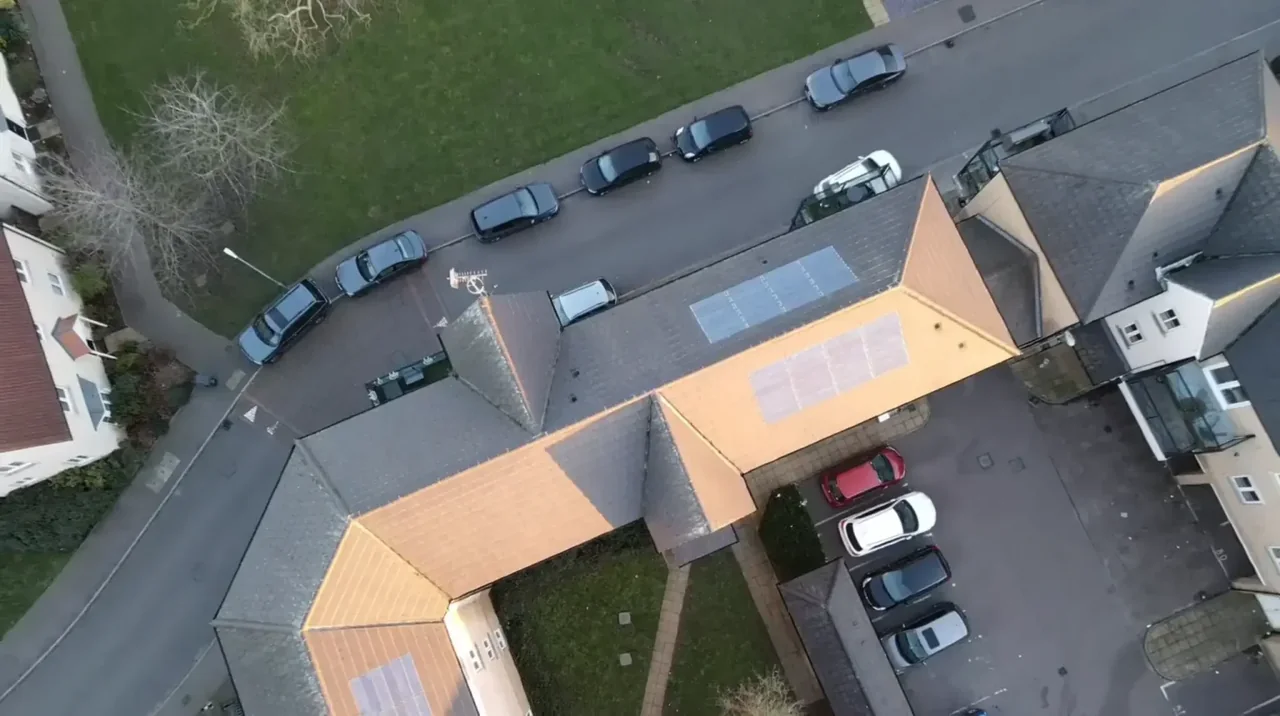
The buildings and sites we survey in Ingatestone
The High Street is the core: timber-framed sixteenth-century houses refronted in painted or exposed brick, early eighteenth-century red and blue brick terraces converted to shops with accommodation over, and nineteenth-century shopfronts inserted beneath older roofs. Roof coverings are predominantly clay peg and plain tile with some slate, steeply pitched, with concealed valleys, deep parapets on the later brick fronts and tall shared stacks. Fryerning and Station Lane add their own conservation areas, and Ingatestone Hall — the Tudor house built for Sir William Petre between 1539 and 1556 — sits south-east of the village. Interwar and postwar housing fills in along Fryerning Lane and Roman Road, with converted barns on the outskirts.

What we get asked for in Ingatestone
Surveys we fly in Ingatestone
Every survey is scoped to your project before we fly — you receive the outputs that are actually useful to you, and a clear, no-obligation quote first.




Drone surveys in Ingatestone — frequently asked questions
Do I need permission to have a listed building surveyed by drone?
Aerial imagery can help record visible roof condition in Ingatestone without attaching equipment to the building. We review access, people and activity nearby, current airspace information and the operating limits that apply to the proposed work. Any required permissions must be obtained, and suitable weather is needed on the day. We confirm feasibility and the scope we can capture before booking; if the flight cannot be carried out safely and lawfully, we discuss an alternative or decline the work.
Can you work along the High Street without closing it?
In most cases yes, and that is usually the point of booking us. There is no scaffold, no lift and no obstruction of the footway, and the operator stays on the ground throughout. What we do need is a launch point that keeps the required separation from pedestrians and traffic, so we typically use a rear yard, garden or car park rather than the pavement itself, agreed with you beforehand.
How far is Ingatestone from your base?
About eleven miles by road from North Weald near Epping, out through Ongar on the A414 and down. Ingatestone is one of the closest towns in this cluster to us, which makes short-notice and weather-dependent bookings genuinely practical rather than a scheduling problem.
Will the imagery be detailed enough to see individual slipped tiles?
Yes. We capture wide context imagery of the whole roof and then close-up detail shots of the specific areas that matter, which on Ingatestone roofs usually means the valleys, the stack heads and the junction between the old roof and any nineteenth or twentieth-century extension. The written report describes what was seen in plain English, and we are clear about what the survey does not show.
We also cover, near Ingatestone
Based in North Weald, Epping and covering London, Essex, Hertfordshire, Kent and the wider South East. If your site is not listed, check we cover it →
