

Drone Surveying in London & Essex
Aerial data capture, mapping, inspection and monitoring for construction, property and infrastructure projects — flown safely and legally, with minimal disruption to your site.
Request a quoteUsable aerial data, from angles the ground cannot reach.
London Drone Surveys captures high-resolution imagery and survey data from angles the ground cannot reach, across London, Essex, Hertfordshire, Kent and the wider South East. From a single aerial inspection to ongoing project monitoring, you get usable data without putting people at height or halting your works.
Every flight is carried out by a professional drone operator in line with CAA regulations and the UK Drone Code. From first enquiry to final delivery, we keep the survey quick, safe and low-impact so your project keeps moving.
How a drone survey works, from enquiry to data
Initial Enquiry
We start by talking through what you need the survey to achieve — the site, the questions you want answered and the outputs that matter. We check the location and any airspace considerations, then send a tailored quote on scope with no obligation. Our knowledge of London and Essex airspace means the survey is set up to be flown safely and legally from the outset.
Shoot Day
On the day, our operator attends site and captures the data using a professional survey-grade drone, working methodically across the whole area. Flying is quick and low-impact — no scaffolding, no cherry pickers and usually no need to stop your works. We agree timing in advance and work around your operations wherever possible.
Analysis & Evaluation
Back at base, we process the raw capture into usable outputs — reviewing imagery, stitching maps and flagging anything of note — so you receive clean, finished data rather than a folder of raw files. You then get your agreed deliverables, and we walk you through the findings so you can move straight to your next decision.
A complete picture ground methods can't match
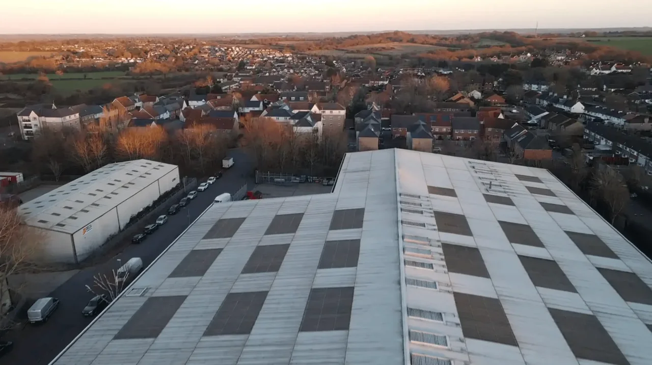
Drone surveying gives you an elevated, complete picture of a site that ground-based methods simply cannot match. Using a professional survey-grade drone, we capture high-resolution imagery and survey data across construction sites, commercial property, land and infrastructure — everything from a single inspection to progress monitoring across the life of a build.
It is built for owners, developers, project teams, designers and managing agents who need reliable, up-to-date information to plan, cost and sign off with confidence. Because every survey is scoped to your project, you only pay for the outputs you actually need, agreed with our team before we ever leave the ground.
Faster, safer and genuinely complete
A drone can cover a large site in a fraction of the time it takes a ground team, so you get your data in days rather than weeks. Inspecting roofs, structures and difficult ground from the air also removes the need to put people at height or in hazardous positions — fewer risks, fewer access arrangements, and none of the cost and delay of scaffolding, cherry pickers or road closures.
The traditional approach leaves gaps: roofs, tall structures, unstable ground and awkward corners that are dangerous or impossible to reach on foot. From above, those areas are straightforward, giving owners, designers and project teams the same accurate picture — clear data for better decisions, with minimal disruption to your operations.
Which drone survey do you actually need?
"Drone survey" covers a lot of ground, and the right one for you depends on what question you are trying to answer. Here is the plain version.
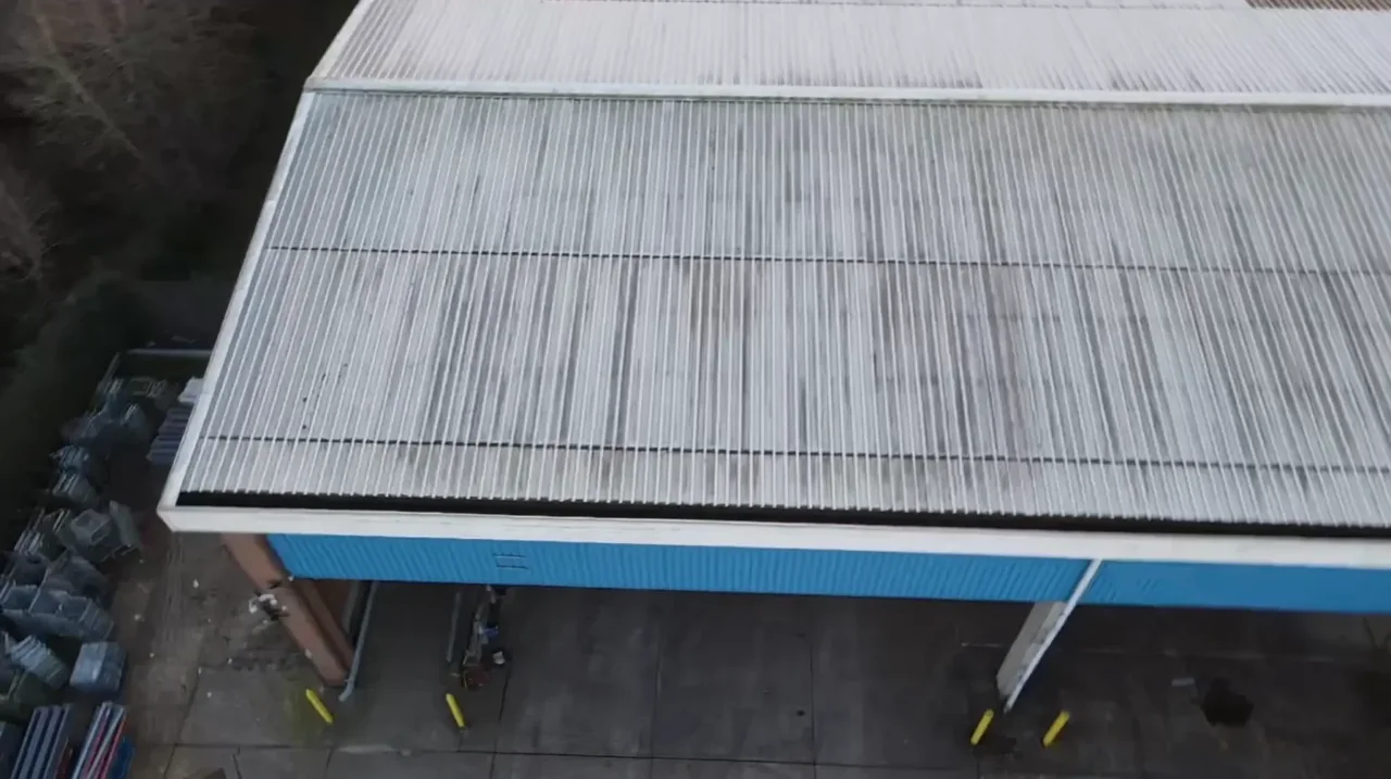
You want to know the condition of a roof. Slipped slates, cracked ridges, failed flashing, blocked high-level gutters, a leak you cannot trace — that is a drone roof survey. It looks at the roof plane in close detail and comes back with annotated imagery your roofer can quote from.
You want to know the condition of a building's walls and elevations. Cracked pointing, spalled brick, failed cladding fixings, parapets, skylights, a dilapidations record at the end of a lease — that is a drone building survey. Same idea as a roof survey, turned through ninety degrees.
You want to know what is on a piece of land and how big it is. Boundaries, access points, structures, tracks, drainage, how the parcel sits against its neighbours — that is a drone land survey, and it comes with a scaled orthomosaic you can measure approximate areas from.
You want to know how the ground rises and falls, to scale. Contours, spot heights, gradients, cut-and-fill, a topographical drawing for a planning application — that is a drone topographic survey. It is the one your engineer or architect will ask for by name.
You want progress monitoring, thermal capture, or something that spans more than one of the above. That is this page. Tell us the outcome you need and we will scope it — most larger jobs end up being a combination rather than one neat category.
Still not sure? Ring us on 020 8058 0914 and describe the site. Two minutes on the phone usually settles it, and there is no charge for working out what you need.
What you get from a drone survey
Every survey is scoped to your project — you receive the outputs that are useful to you, agreed before we fly.
High-resolution aerial imagery
Sharp, geolocated stills of your site from above and at angle, for records, planning and progress documentation.
Aerial video footage
Smooth video passes over and around the site — useful for stakeholder updates, marketing and showing a project in context.
Written survey report
A clear, plain-English report summarising what was captured and any observations of note, with reference imagery.
Basic site basemap
A stitched top-down basemap of the surveyed area for site-layout planning and progress overlays.
3D model or point cloud
A digital 3D reconstruction of the site or structure for detailed measurement and design reference.
Thermal imaging capture
Heat-signature imagery to help identify moisture ingress, heat loss or hidden defects on structures.
What drives the cost of a drone survey
Your quote is based on the property or site, the access available and the outputs you need. Send us the address, the question you want answered and any deadline. We will confirm the proposed scope and price before you decide whether to book.
What happens on survey day
Before we attend. We confirm the date with you, check the airspace and any height limits over your site, and agree where we will take off and land from. If the location needs particular permissions or arrangements, that is sorted before the day, not on it.
On arrival. Our operator introduces themselves, walks the area, and sets up in a safe spot on the ground. On a working site we will fit around your induction and your programme — we would rather wait twenty minutes than get in the way of a lift.
The flight. A professional survey-grade drone flies a planned pattern across the area, capturing methodically rather than freehand, so nothing is missed and the coverage is consistent. Most surveys are a single short visit. There is no scaffolding, no cherry picker and, in most cases, no need to stop your works.
Before we leave. We check the capture on site. If anything needs re-flying, it gets re-flown then and there rather than turning into a second visit.
You do not need to be on site while we fly, though you are welcome to be. What we do need is access to the ground we will take off and land from, and a reasonably calm, dry window — drones need decent conditions to fly safely and capture clean data, so occasionally we will move a date rather than fly in the wrong weather and give you imagery you cannot use. If a date has to move, we tell you as early as we can.
Your deliverables, and the formats they arrive in
Everything is agreed at the briefing stage, so you receive finished outputs rather than a folder of raw files — and nothing you did not ask for.
| Deliverable | Format | Notes |
|---|---|---|
| Aerial imagery | High-resolution JPEG | Geolocated where the job calls for it |
| Aerial video | MP4 | Smooth passes over and around the site |
| Written survey report | Plain English, findings tied to reference imagery | |
| Site basemap | Stitched image, plus PDF | Top-down, for layout planning and progress overlays |
| 3D model / point cloud | Agreed at briefing | For measurement and design reference — tell us what your software needs |
| Thermal capture | Radiometric imagery, plus PDF summary | Helps flag moisture ingress, heat loss and hidden defects |
Turnaround. The survey itself is usually a single short visit. Imagery, video and the written report typically follow within a few days. Modelled outputs — 3D, point cloud, thermal analysis — take a little longer because there is real processing behind them; we will give you a date at the briefing rather than a vague promise. If something is genuinely urgent, tell us at the enquiry stage and we will do our best to prioritise it.
If you have a particular file type, coordinate system or contour interval your team works in, say so at the briefing and we will match it where we can.
Drone surveying vs traditional ground survey
| Traditional ground survey | Drone survey | |
|---|---|---|
| Access | Scaffolding, cherry pickers, road or footpath closures | None — flown from a safe spot on the ground |
| Time on site | Days, plus time erecting and dismantling access | A single short visit in most cases |
| Coverage | Sample points and what a person can safely reach | The whole area, captured densely and consistently |
| Working at height | Yes | None — the operator stays on the ground |
| Disruption | Works often pause | Minimal; in most cases your team keeps working |
| What you end up with | Notes and measurements | High-resolution imagery, video, mapped outputs and a plain-English report |
We are not going to tell you a drone replaces every ground method — for some tasks it does not, and where that is the case we will say so. What it does replace is the slow, costly and risky part: getting eyes on things that are high, awkward or spread across a large site.
Why choose drone surveying over ground methods
Faster than traditional methods
A drone covers a large site in a fraction of the time a ground team takes, so you get your data in days rather than weeks.
Safer for everyone on site
Inspecting roofs, structures and difficult ground from the air removes the need to put people at height or in hazardous positions.
Access to the unreachable
Roofs, tall structures, unstable ground and awkward corners that are dangerous on foot are straightforward from above.
Minimal disruption to operations
Surveys are quick and non-invasive — in most cases your team keeps working while we fly, with no closures or shutdowns.
Clear data for better decisions
High-resolution imagery and measurable maps give everyone the same accurate picture to plan, cost and sign off with confidence.
Where drone surveying is used
Where we fly — London, Essex and the South East
We are based in North Weald, Epping, and we cover London, Essex, Hertfordshire, Kent and the wider South East. Being local matters more than it sounds: much of this patch sits under controlled airspace or close to aerodromes such as North Weald Airfield and Stapleford, so knowing the ground and the airspace means permissions are handled early and your survey is planned properly from the first phone call rather than the day before.
We survey regularly across Epping, North Weald, Harlow, Loughton, Buckhurst Hill, Chipping Ongar, Brentwood, Shenfield, Chelmsford, Billericay, Basildon, Braintree, Great Dunmow, Stansted Mountfitchet, Waltham Abbey, Upminster, Romford, Grays and Thurrock in Essex and east London, and across Westminster, Kensington, Chelsea, Belgravia, Mayfair, Notting Hill, Paddington, Marylebone, Pimlico, Holborn, the City of London, Hammersmith, Fulham, Putney, Wimbledon, Lambeth and Ealing in central and west London — plus Hertfordshire, Kent and the wider South East.
Not sure whether we cover you? Check we cover your site →
Drone surveying — your questions answered
What is a drone survey and how does it work?
A drone survey uses an uncrewed aircraft fitted with a high-resolution camera to capture imagery and data of a site or structure from above. We plan the flight around your location, fly the area methodically on the day, then process the capture into usable outputs such as imagery, video, maps and a written report. It replaces slower, riskier methods like scaffolding, cherry pickers or ground teams walking a large site.
Which areas do you cover?
We are based in North Weald, Epping, and cover London, Essex, Hertfordshire, Kent and the wider South East. Because we are local, we know the ground and the airspace, which means less time spent working out access and permissions and a faster turnaround for you.
Are there airspace restrictions I should know about in Essex?
Often, yes. Commercial and infrastructure sites frequently sit under controlled airspace or close to active aviation sites such as North Weald Airfield and Stapleford Aerodrome. We assess the controlled-airspace picture and any height limits for your specific site when scoping the job, plan the flight so it is carried out safely and legally, and tell you up front if a location needs extra arrangements.
Is drone surveying legal, and how do you fly safely?
Yes. All our flights are carried out by a professional drone operator in line with CAA regulations and the UK Drone Code. That covers where and how we can fly, keeping a safe distance from people and property, and respecting airspace restrictions. We plan every mission around these rules so the survey is completed safely and legally.
Will the survey disrupt my site or business?
Very little. Drone surveys are quick and non-invasive — there is no scaffolding to erect, no access equipment to hire and usually no need to stop work. In most cases your team carries on as normal while we fly, and we agree timing with you in advance.
How much does a drone survey cost?
Every site is different, so we price each survey on scope — the size of the area, the outputs you need and any access or airspace considerations. Tell us what you are trying to achieve and we will send a clear, no-obligation quote, with no surprises later.
Do I need to be on site while you fly?
No. Most clients are not, and we are happy to attend, survey and report without you having to block out a day. If you would rather be there to point things out, that is genuinely useful and you are welcome — just tell us at the booking stage.
What happens if the weather is bad on the day?
We move it. Drones need reasonably calm, dry conditions to fly safely and capture clean data, and flying in the wrong weather produces imagery you cannot rely on. We watch the forecast and give you as much notice as we can, then rebook at the first sensible window.
Can you survey a site that is still in use?
Usually, yes. Drone surveys are quick and non-invasive — there is nothing to erect and nothing to dismantle — so in most cases your team carries on working while we fly. We agree timing with you in advance and fit around your operations.
Do you do thermal imaging?
Yes. Thermal capture records heat signatures across a structure, which helps flag moisture ingress, heat loss and defects that are not visible in ordinary imagery. It is scoped as part of the survey rather than sold separately — tell us what you are trying to find and we will say honestly whether thermal will help.
Can you monitor a construction site over time rather than survey it once?
Yes, and it is one of the things drones are best at. Repeat flights over the same site, flown to the same plan, give you a consistent visual record of progress you can put in front of a client, a funder or a project board. Repeat visits to a site we already know are quicker to set up and quoted accordingly.
What is the difference between a drone survey and a measured building survey?
A drone survey captures what a site or structure looks like and, depending on the scope, produces measurable outputs such as a scaled basemap, a topographical drawing or a 3D model. A measured building survey in the traditional sense is a different discipline with its own tolerances. If your architect has asked for something specific, send us the brief and we will tell you plainly what a drone survey will and will not give you.
Specialist surveys we also fly




Ready to elevate your surveying experience?
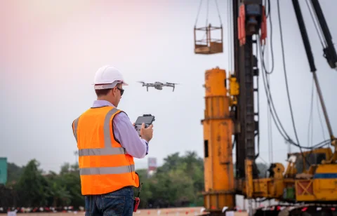
Tell us about your site and what you need the survey to achieve, and our team will come back with a clear, no-obligation quote for work across London, Essex and the South East.
Talk to the team