

Local drone surveys in Tilbury, planned around the site and the airspace.
Tilbury exists because of the docks. The town was laid out after the deep-water docks opened in 1886, and its shape still follows the port — the Dwellings and the dockers' terraces off Dock Road and Calcutta Road, then a belt of 1920s and 1930s housing put up by the young urban district council. West of the town is Tilbury Fort, the historic artillery fort in English Heritage care, and the riverside cruise terminal; east of it, Tilbury2 has been built out on the old power station land. The result is a place where a survey is rarely just a building. It is usually a parcel — acres of yard, hardstanding, made ground and moving boundary that need a scaled plan rather than a photograph.
The buildings and sites we survey in Tilbury
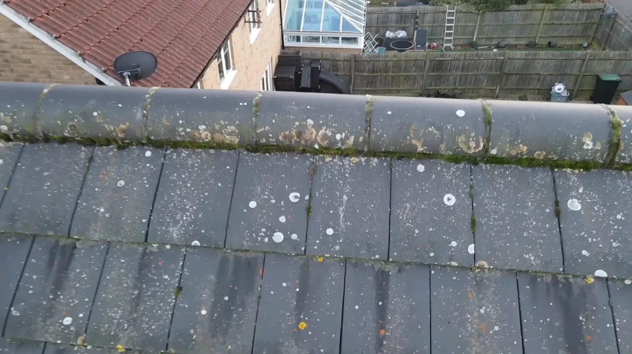
Tilbury's houses are mostly early-twentieth-century and municipal. The dock company's four-storey Dwellings and the terraces around Dock Road, Calcutta Road and Montreal Road are late-Victorian and Edwardian, with slate and clay tile roofs in long shared runs and stacks along the party lines. Around them sit interwar and post-war council semis and short terraces in low-pitched concrete tile, plus newer infill such as the St Chads redevelopment. Three miles east, East Tilbury is a different world altogether: the 1930s Bata estate is a designated conservation area of flat-roofed white modernist houses and factory buildings, several of them listed — flat roofs and rendered elevations that need a different inspection approach entirely.

What we get asked for in Tilbury
Surveys we fly in Tilbury
Every survey is scoped to your project before we fly — you receive the outputs that are actually useful to you, and a clear, no-obligation quote first.




Drone surveys in Tilbury — frequently asked questions
Can you survey inside the Port of Tilbury?
Only where the port operator sponsors the visit. The dock estate is secure private land with its own access control, so permission to be there is a separate question from whether the airspace is clear — we need both. In practice the client arranges site access and we handle the flight planning, the risk assessment and the airspace checks around live quayside and vehicle movements.
Why a land survey rather than a roof survey for a Tilbury site?
Because most Tilbury briefs are about ground, not buildings. A land survey maps the whole parcel from the air — features, boundaries, layout and extent — and can deliver an orthomosaic, a stitched scaled top-down image suitable for measuring approximate area. If you need engineering-grade contours, levels and spot heights instead, that is a topographic survey, which we offer separately.
Do you survey the Bata houses at East Tilbury?
Yes. The estate's flat roofs and rendered modernist elevations are hard to assess from ground level and awkward to reach safely, which is exactly the case for flying it. Flying above a listed building does not need listed building consent, but the conservation area designation means any subsequent works almost certainly will — we supply the imagery and condition record, your conservation adviser handles the consents.
How far is Tilbury from your base?
It is a longer run than our Epping Forest heartland — M25 to junction 30 from North Weald, then the A13 and A1089 — but still a comfortable single trip. Most Tilbury work is a single short visit, and the imagery, video and written summary usually follow within a few days. Being this local also means we know the ground and the airspace, so permissions get looked at early rather than on the morning.
We also cover, near Tilbury
Based in North Weald, Epping and covering London, Essex, Hertfordshire, Kent and the wider South East. If your site is not listed, check we cover it →
