

Local drone surveys in Grays, planned around the site and the airspace.
Grays is the administrative centre of Thurrock, and the point where a Victorian quarry town runs straight into a riverside regeneration programme. The terraces radiating from the town centre along Orsett Road and William Street went up for chalk and cement workers, and their slate and plain-tile roofs are now well past a century old — slipped slates, cracked ridges and failed valley flashings are the everyday findings here. Above them sit the 1960s and 1970s shopping parades and flat-roofed civic blocks around the High Street and George Street, where the Grade II* State Cinema has been carried on Historic England's Heritage at Risk register. Most of what we are asked to do in Grays is condition evidence: roofs, parapets and rainwater goods photographed properly, from angles nobody reaches off a ladder.
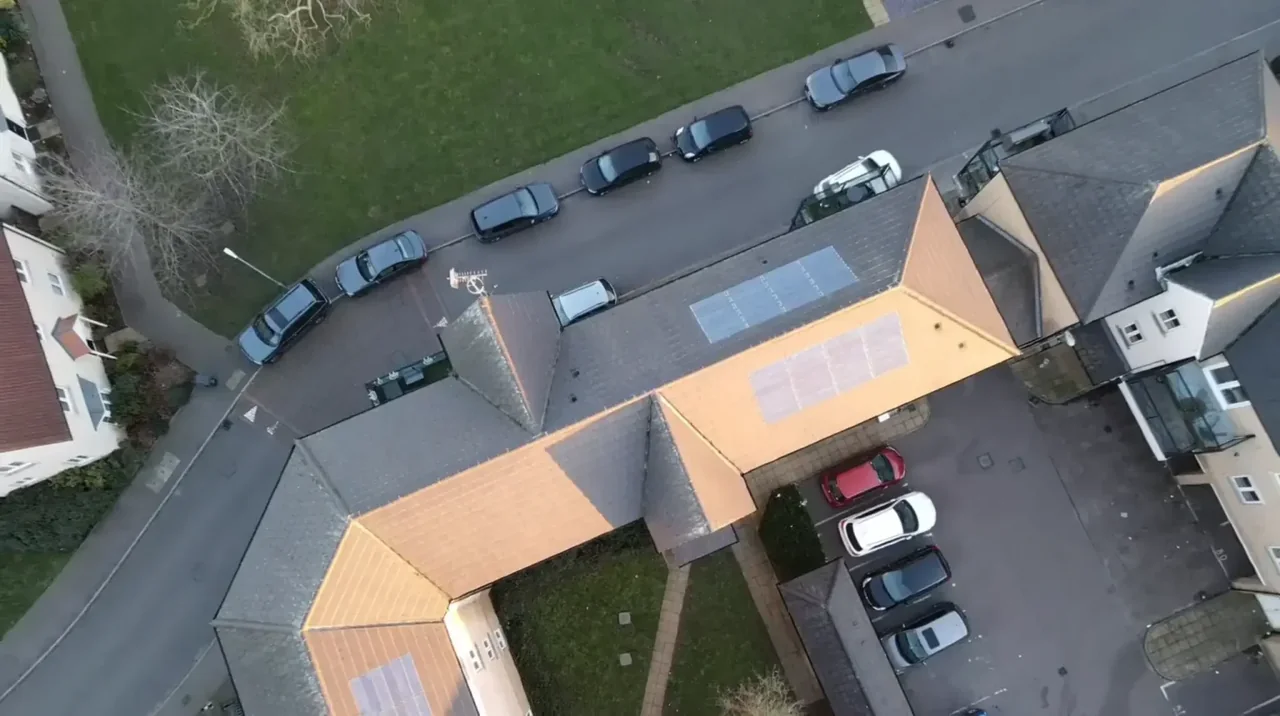
The buildings and sites we survey in Grays
Grays' housing splits three ways. Late-Victorian and Edwardian two-storey terraces run through the RM17 core — natural slate and clay plain tile, shared party parapets, chimney stacks still in use and long unbroken roof runs. Around them are 1930s bay-fronted semis in Little Thurrock and large post-war and 1960s estates at Chadwell St Mary, mostly shallow-pitched interlocking concrete tile with flat-roofed rear additions. To the west, Chafford Hundred and West Thurrock brought late-1980s and 1990s estate housing laid out across the worked-out chalk quarries, and the riverside has since added apartment blocks with membrane roofs and communal balcony decks.

What we get asked for in Grays
Surveys we fly in Grays
Every survey is scoped to your project before we fly — you receive the outputs that are actually useful to you, and a clear, no-obligation quote first.




Drone surveys in Grays — frequently asked questions
Can you survey a terraced roof in central Grays without closing the road?
Usually, yes. The operator stays on the ground and we normally launch from the rear garden, a driveway or a private forecourt rather than the carriageway. What we do need is a short working area kept clear of people who are not part of the job, so we agree a take-off point and a brief cordon with you beforehand. No scaffolding, no ladders and nobody on the roof.
How quickly can you get to a site in Grays?
We are based at North Weald, near Epping, so Grays is a straight run down the M25 to junction 30 and east on the A13. That means most Grays jobs are a single short visit rather than a mobilisation. Imagery, video and your written report usually follow within a few days of the flight.
Do you survey listed buildings and Heritage at Risk properties in Grays?
We can capture them. Flying a drone above a listed building does not itself need listed building consent — but any repair or alteration you go on to carry out very likely will, and that is a planning matter for your architect or conservation officer rather than for us. We supply the high-resolution imagery and a plain-English record of condition to inform that conversation.
Is a drone roof survey enough for an insurance or party-wall dispute?
It is strong evidence, but it is evidence rather than a structural opinion. You get dated high-resolution imagery, close-up detail shots, annotated defect maps and a written report describing what was seen. If a claim or dispute needs a chartered surveyor or structural engineer to sign off on cause and remedy, our imagery is what they work from — we are clear about what the survey will and will not show.
We also cover, near Grays
Based in North Weald, Epping and covering London, Essex, Hertfordshire, Kent and the wider South East. If your site is not listed, check we cover it →
