

Local drone surveys in Kensington, planned around the site and the airspace.
Kensington is one of the harder places in Britain to inspect a roof the traditional way. Streets like Cornwall Gardens, Queen's Gate and De Vere Gardens run five and six storeys of stucco and stock brick with almost no rear access, communal gardens that scaffolders are not permitted to cross, and residents' committees that take a dim view of a pavement licence sitting outside for a month. Add the museum quarter around Exhibition Road, the embassy run along Kensington Palace Gardens, and street after street of conservation-area frontage, and the case for flying is simple — we capture the same defect evidence in a single morning, with nothing bolted to the building and no one working at height.
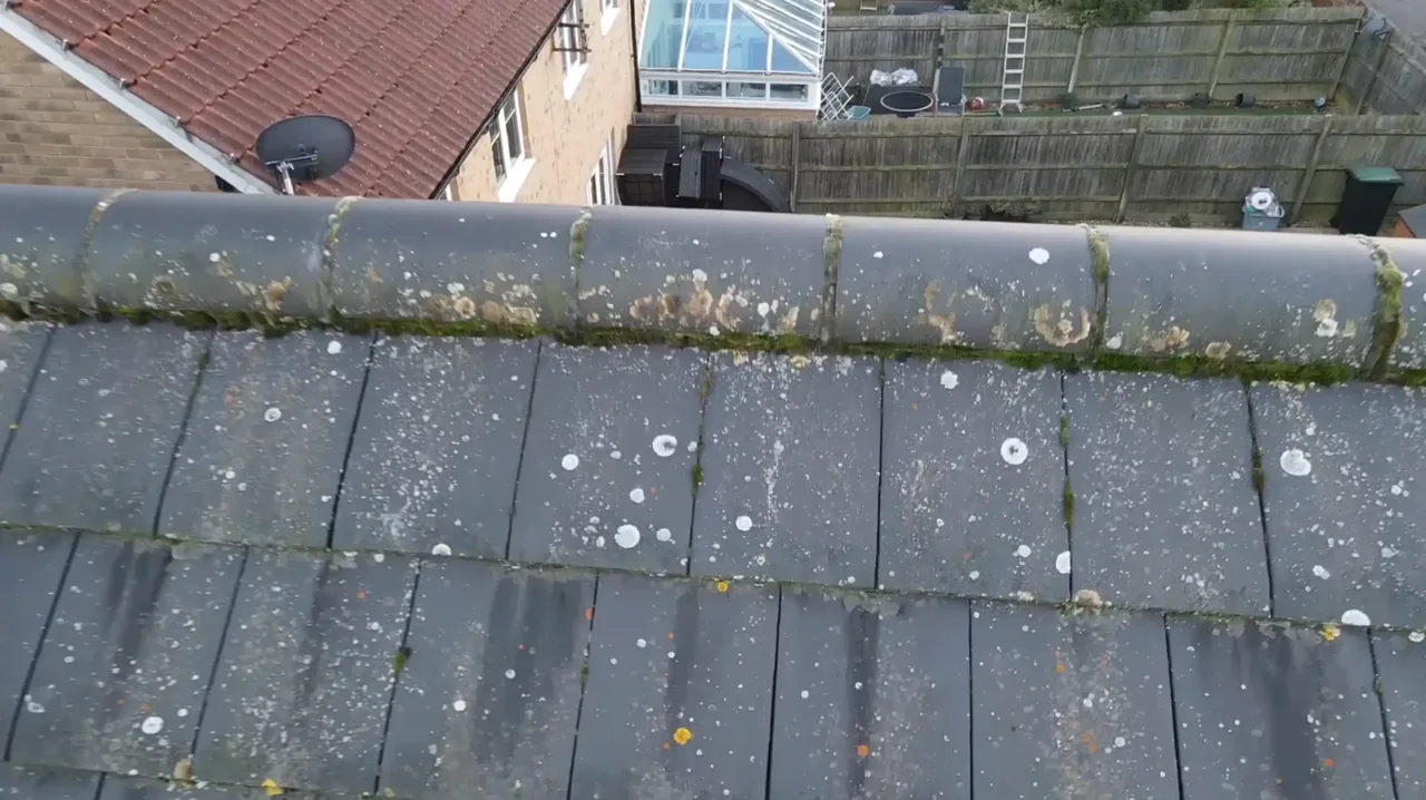
The buildings and sites we survey in Kensington
The stock is overwhelmingly mid-Victorian: 1840s to 1860s Italianate stucco terraces around Queen's Gate and Cornwall Gardens, later red-brick and terracotta mansion blocks in Kensington Court and off Kensington High Street, and a handful of genuinely early houses on Kensington Square. Roofs are typically Welsh slate set behind heavy parapets, with butterfly and valley profiles draining into lead-lined box gutters that cannot be seen from the street at all, plus later mansard extensions and rooftop plant. The failures are predictable — cracked parapet copings, perished lead soakers, blocked hidden valleys and stucco spalling at cornice level — and every one of them sits where a ladder cannot reasonably reach.

What we get asked for in Kensington
Surveys we fly in Kensington
Every survey is scoped to your project before we fly — you receive the outputs that are actually useful to you, and a clear, no-obligation quote first.




Drone surveys in Kensington — frequently asked questions
Can you survey a Kensington roof without scaffolding or a pavement licence?
That is usually the reason people call us. The survey is a single short visit with our operator safely on the ground, so there is no tower, no cherry picker and no licence application for the footway. We agree a take-off point with you beforehand — often a private forecourt, courtyard or roof terrace rather than the public pavement — and the street carries on as normal while we work.
My house is listed and inside a conservation area. Does that change anything?
Aerial imagery can help record visible roof condition in Kensington without attaching equipment to the building. We review access, people and activity nearby, current airspace information and the operating limits that apply to the proposed work. Any required permissions must be obtained, and suitable weather is needed on the day. We confirm feasibility and the scope we can capture before booking; if the flight cannot be carried out safely and lawfully, we discuss an alternative or decline the work.
Do you need permission to fly near Kensington Gardens or Kensington Palace?
We assess each Kensington site individually before confirming a drone survey. We review access, people and activity nearby, current airspace information and the operating limits that apply to the proposed work. Any required permissions must be obtained, and suitable weather is needed on the day. We confirm feasibility and the scope we can capture before booking; if the flight cannot be carried out safely and lawfully, we discuss an alternative or decline the work.
How far is Kensington from your base, and does that affect scheduling?
We are based at North Weald, Epping, roughly 27 miles by road. In practice that means we favour an early slot in Kensington — arriving before the school run and the delivery traffic keeps the street quiet, keeps uninvolved people well clear, and gets the flight done inside a morning. Imagery, video and the written report usually follow within a few days.
We also cover, near Kensington
Based in North Weald, Epping and covering London, Essex, Hertfordshire, Kent and the wider South East. If your site is not listed, check we cover it →
