

Local drone surveys in Marylebone, planned around the site and the airspace.
Marylebone is unusual in that most of it still has a landlord. The Howard de Walden Estate holds the medical core — Harley Street, Wimpole Street, Devonshire Place, Welbeck Street — and the Portman Estate covers much of the ground west towards Edgware Road. That means survey work here is often commissioned by an estate or its managing agent rather than an individual owner, and it is usually about planned maintenance across a run of buildings rather than one emergency. Georgian townhouses in continuous professional use, Edwardian and interwar mansion blocks, and clinical conversions carrying heavy rooftop plant are the three things we end up photographing most often.
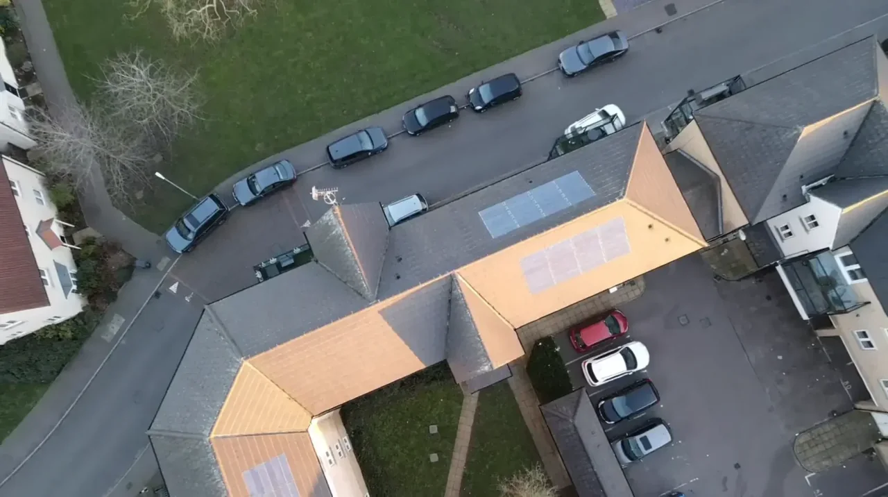
The buildings and sites we survey in Marylebone
Conservation-area streets set the character across the Harley Street and Portman districts: brown and yellow stock brick Georgian townhouses of four to six storeys with parapets, slate mansards, dormers and concealed valley gutters, many of them altered for medical use with air handling and condenser units added at roof level over the years. Marylebone also holds a large stock of purpose-built Edwardian and interwar mansion blocks — red brick and Portland stone, deep parapets, tiled and slated roofs and long communal gutter runs. Behind the main streets, mews terraces are two and three storeys with small flat and pitched roofs, frequently converted.

What we get asked for in Marylebone
Surveys we fly in Marylebone
Every survey is scoped to your project before we fly — you receive the outputs that are actually useful to you, and a clear, no-obligation quote first.




Drone surveys in Marylebone — frequently asked questions
Do we need the estate's permission as well as our own?
We assess each Marylebone site individually before confirming a drone survey. We review access, people and activity nearby, current airspace information and the operating limits that apply to the proposed work. Any required permissions must be obtained, and suitable weather is needed on the day. We confirm feasibility and the scope we can capture before booking; if the flight cannot be carried out safely and lawfully, we discuss an alternative or decline the work.
Can you survey several buildings on the same street in one visit?
Yes, and in Marylebone that is normally the efficient way to do it. Terraced townhouses in single estate ownership share parapets, gutters and roof planes, so one flight can record a run of properties and the report can then be split building by building. Agreeing the exact addresses and the boundaries between them beforehand keeps the annotated defect map unambiguous when costs are apportioned.
Can you launch from Regent's Park?
For a site in or beside managed open space in Marylebone, we check the relevant access rules and restrictions as well as the airspace. We do not assume that a park, forest or reserve is available for drone operations. We review access, people and activity nearby, current airspace information and the operating limits that apply to the proposed work. Any required permissions must be obtained, and suitable weather is needed on the day. We confirm feasibility and the scope we can capture before booking; if the flight cannot be carried out safely and lawfully, we discuss an alternative or decline the work.
How far is Marylebone from your base?
We are based at North Weald near Epping, roughly 25 miles by road from W1, so travel is not the constraint. What sets the timescale is the planning: agreeing a launch point with the building or the estate, completing the ground risk assessment, and confirming on the NATS restriction map that the specific address is clear. Straightforward Marylebone jobs are usually a matter of days rather than weeks.
We also cover, near Marylebone
Based in North Weald, Epping and covering London, Essex, Hertfordshire, Kent and the wider South East. If your site is not listed, check we cover it →
