

Local drone surveys in Epping, planned around the site and the airspace.
Epping is home turf. Our base is at North Weald, about three miles up the B1393 by road, so an Epping survey is a short run out rather than a trip round the M25. The work here splits three ways. Period roofs on and around the High Street conservation area, where Georgian and Victorian frontages carry slate and clay-tile pitches nobody wants to scaffold just to take a look. Green Belt plots, paddocks and stables on the fringes at Coopersale and Epping Upland, where owners need boundaries and extents mapped before a planning application. And light-industrial stock on Bower Hill and out at North Weald, where flat roofs, rooflights and rainwater goods fail quietly for years before anyone notices a stain on a ceiling tile.
The buildings and sites we survey in Epping
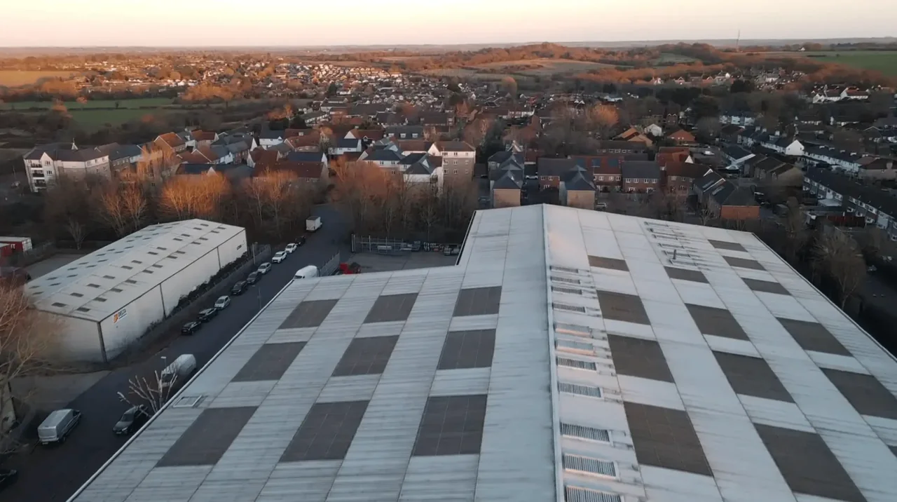
Epping's centre is a long High Street conservation area holding over thirty statutorily or locally listed buildings — Georgian brick townhouses with sash windows and parapets, a run of Victorian shopfronts with living accommodation above, and a few 17th-century timber-framed survivors, the Black Lion among the oldest. Behind the High Street sit interwar and post-war semis around Hemnall Street, Bury Lane and Ivy Chimneys, then later estates towards Coopersale. Commercial stock concentrates on Bower Hill Industrial Estate and at North Weald Airfield, where large-span profiled-metal and flat-felt roofs dominate. Coopersale and Epping Upland add cottages, converted farm buildings and stabling on larger Green Belt plots.

What we get asked for in Epping
Surveys we fly in Epping
Every survey is scoped to your project before we fly — you receive the outputs that are actually useful to you, and a clear, no-obligation quote first.




Drone surveys in Epping — frequently asked questions
How quickly can you get to a site in Epping?
Epping is our nearest town — we are based at North Weald, about three miles away by road. That usually means we can offer a wider choice of dates than for jobs further into London, and a survey visit is normally a single short attendance rather than a half-day allowance for travel. Tell us the address and what you need the survey to show, and we will come back with a clear, no-obligation quote.
Can you survey a listed building on Epping High Street?
Yes. A drone survey is a good fit for listed and locally listed stock precisely because it is non-contact — nothing touches the fabric, no scaffold ties, no ladder feet on a parapet. We capture high-resolution imagery of the roof covering, leadwork, parapets and chimney stacks and give you a plain-English report. Flight planning has to account for the narrow street and pedestrians, so we normally agree a quieter time of day.
Does North Weald Airfield stop you flying over Epping?
The answer depends on the exact address in Epping, the current airspace restrictions and the proposed flight. Proximity to an airport or a place name alone does not establish whether a flight is possible. We review access, people and activity nearby, current airspace information and the operating limits that apply to the proposed work. Any required permissions must be obtained, and suitable weather is needed on the day. We confirm feasibility and the scope we can capture before booking; if the flight cannot be carried out safely and lawfully, we discuss an alternative or decline the work.
Can you take off from Epping Forest land at Bell Common?
For a site in or beside managed open space in Epping, we check the relevant access rules and restrictions as well as the airspace. We do not assume that a park, forest or reserve is available for drone operations. We review access, people and activity nearby, current airspace information and the operating limits that apply to the proposed work. Any required permissions must be obtained, and suitable weather is needed on the day. We confirm feasibility and the scope we can capture before booking; if the flight cannot be carried out safely and lawfully, we discuss an alternative or decline the work.
We also cover, near Epping
Based in North Weald, Epping and covering London, Essex, Hertfordshire, Kent and the wider South East. If your site is not listed, check we cover it →
