

Local drone surveys in Loughton, planned around the site and the airspace.
Loughton is the biggest town in the Epping Forest district and the survey work reflects that spread. East of the old town is Debden, the London County Council estate built between 1947 and 1952 to rehouse bombed-out Londoners — thousands of tiled hipped roofs, long terraced runs and parapet gutters now well past their first refurbishment cycle. South of that, Langston Road and Oakwood Hill carry retail park sheds and industrial units with large single-ply and profiled-metal roofs that are slow and risky to walk. And in between sits old Loughton: a clutch of conservation areas and dozens of listed and locally listed buildings, most of them steep-pitched, tall and awkward to reach from a ladder.
The buildings and sites we survey in Loughton
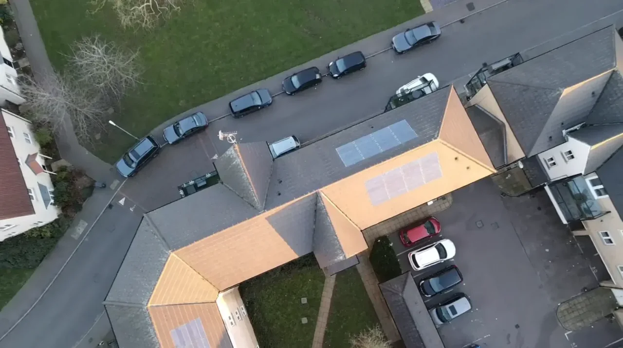
Loughton runs from Victorian and Edwardian villas along the High Road and up towards Baldwins Hill and The Warren, where large detached houses back directly onto Forest land, down to the Debden estate east of the old town — LCC-built between 1947 and 1952, with later council housing and prefabricated homes along Oakwood Hill and Roding Road. Between them are interwar semis on Alderton Hill and Roding Road, most now carrying loft conversions and rear extensions. Commercial stock concentrates on Oakwood Hill Industrial Estate opposite Debden station and at the retail park on Langston Road, both large-footprint flat and shallow-pitch roofs with plant, rooflights and long rainwater runs.

What we get asked for in Loughton
Surveys we fly in Loughton
Every survey is scoped to your project before we fly — you receive the outputs that are actually useful to you, and a clear, no-obligation quote first.




Drone surveys in Loughton — frequently asked questions
Do you cover the Debden estate and Debden Broadway?
Yes. Debden is a large part of what we do in Loughton — the LCC housing built between 1947 and 1952 has reached the age where roof coverings, hipped ridges and parapet gutters need documenting properly. We are happy to quote for anything from an individual property to a run of terraces flown in a single visit, providing annotated imagery a managing agent or contractor can price from without hiring access equipment first.
Can you inspect industrial roofs at Oakwood Hill or Langston Road?
That is one of the clearest cases for a drone. Large-span single-ply and profiled-metal roofs with rooflights are hazardous to walk and often need permits, edge protection or a MEWP before anyone goes up. We fly the whole roof, capture close detail on laps, flashings, upstands and plant surrounds, and deliver imagery plus a written condition report — normally without interrupting trading or production below.
How does Stapleford Aerodrome affect a survey in Loughton?
The answer depends on the exact address in Loughton, the current airspace restrictions and the proposed flight. Proximity to an airport or a place name alone does not establish whether a flight is possible. We review access, people and activity nearby, current airspace information and the operating limits that apply to the proposed work. Any required permissions must be obtained, and suitable weather is needed on the day. We confirm feasibility and the scope we can capture before booking; if the flight cannot be carried out safely and lawfully, we discuss an alternative or decline the work.
Where do you take off from on a Forest-edge property?
For a site in or beside managed open space in Loughton, we check the relevant access rules and restrictions as well as the airspace. We do not assume that a park, forest or reserve is available for drone operations. We review access, people and activity nearby, current airspace information and the operating limits that apply to the proposed work. Any required permissions must be obtained, and suitable weather is needed on the day. We confirm feasibility and the scope we can capture before booking; if the flight cannot be carried out safely and lawfully, we discuss an alternative or decline the work.
We also cover, near Loughton
Based in North Weald, Epping and covering London, Essex, Hertfordshire, Kent and the wider South East. If your site is not listed, check we cover it →
